
Mine subsidence monitoring, automated.
Send us a KML polygon. Get calibrated deformation maps, PDF reports, and live web-GIS layers on your monitoring schedule.
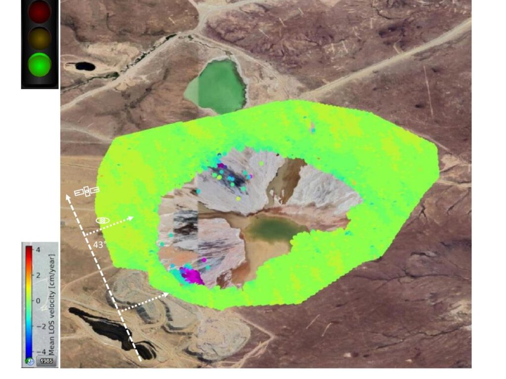
Built for the people who already know why ground motion matters.
Deploy IRMI™ on edge hardware, a single server, private cloud, or public cloud without changing the core processing system.
Mine Operators
Open-pit and underground operations needing continuous, site-scale monitoring without standing up an in-house remote-sensing team.
Tailings Dam Engineers
Wall integrity, basin subsidence, freeboard context, and post-deposition consolidation, monitored every cycle.
Geotechnical Consultants
An independent, repeatable measurement layer to support design reviews, dam-safety inspections, and engineer-of-record reporting.
Closure and Rehabilitation
Long-baseline monitoring of legacy facilities and rehabilitated land after operations end.
Regulators
Operator-independent subsidence evidence aligned with tailings governance and dam-safety review.
Insurers and ESG Analysts
Quantitative ground-motion evidence across portfolios, jurisdictions, and reporting periods.
Tailings risk often starts as movement
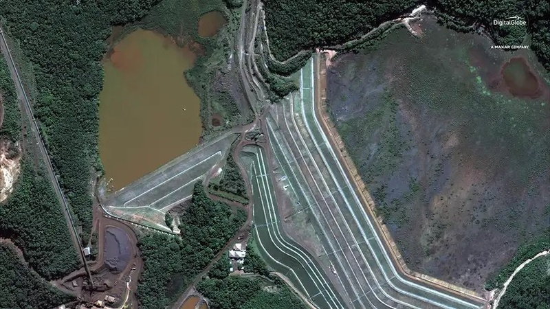
Córrego do Feijão tailings storage facility, Brumadinho, Brazil — operational state.
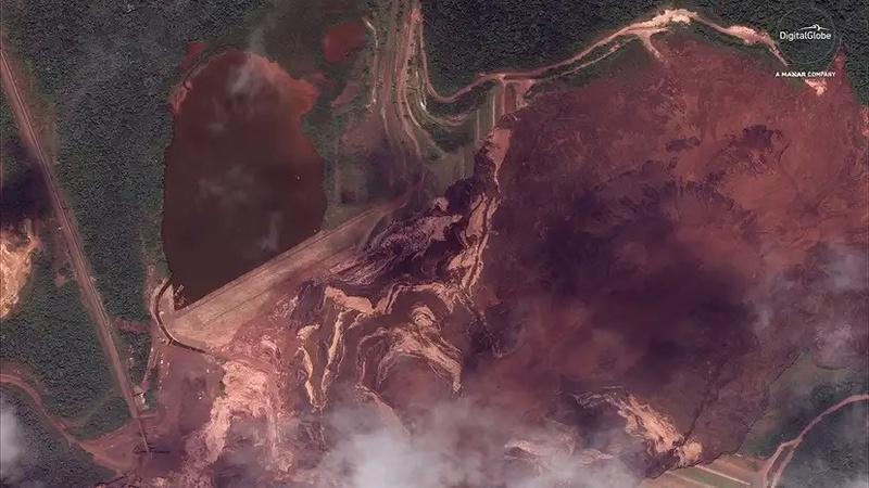
≥ 270 lives lost · wall failure in seconds · InSAR-detectable in advance. Imagery: Maxar / DigitalGlobe.
After Brumadinho, regulators, investors, and mine operators moved toward one clear requirement: continuous, independent, evidence-based monitoring of tailings storage facilities.
Differential SAR Interferometry, dInSAR, compares repeated satellite passes to detect millimetre-scale ground movement without instruments on the wall, surveyors at the toe, or drones in the wind.
For mines, the fit is direct: defined areas of interest, measurable ground movement, recurring monitoring needs, and a strong requirement for defensible evidence.
Four steps, end-to-end automated.
Upload one polygon. EOIntelligence retrieves the SAR data, runs the dInSAR chain, applies corrections, and delivers a PDF report plus interactive web map on every Sentinel-1 revisit.
01
Define the AOI
Upload a KML polygon for the mine, tailings facility, or lease boundary. Set the monitoring interval.
02
Automated ingest
EOIntelligence retrieves the required SAR stack, DEM, and atmospheric data for the selected area and period.
03
Differential InSAR
The system estimates coherence, builds interferograms, unwraps phase, and maps displacement.
04
Delivery
Receive a PDF report and private web-map for operators, engineers, and field teams.
Phase-linking dInSAR combines the strengths of SBAS and PSI.
SBAS
Small BaselineBroad coverage on bare and semi-vegetated terrain.
PSI
Persistent ScatterersHigh precision on stable, hard targets.
Phase Linking
EOI HybridDense measurement coverage with stable time-series outputs.
• SBAS provides broader coverage, but at a coarser grid.
• PSI can return sparse points limited to hard structures.
• Phase-linking helps bridge that gap. It retrieves coherent estimates across more native pixels, including the semi-coherent surfaces common around active tailings facilities.
The result: more measurement points, tighter time-series, and fewer voids in complex mine environments.
Two channels. One source of truth.
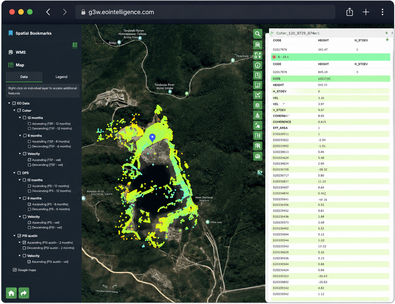
Every cycle delivers a PDF report, a live web-GIS update, and GIS-ready data layers your asset systems can ingest directly. Same data, three lenses.
01
DocumentEngineering-Grade PDF
Mission goals, requirements, and viability.
Start earlier. Launch stronger.
Bring EOIntelligence in before launch to reduce risk and accelerate readiness.