
From raw signal to geoinformation
Every level from L0 to L4, taking your data beyond the classical payload ground segment to the higher-order products most systems stop short of.
Raw input. Reconstructed output.
IRMI™ reconstructs, calibrates, and enhances raw scenes so sensor data can move into the higher processing levels with cleaner geometry, radiometry, and visual consistency.
Raw artefacts reduced
Scan lines, band misalignment, blur, and radiometric inconsistencies are corrected where the data supports recovery.
Calibration applied
Raw signal is moved toward calibrated, enhanced imagery with cleaner geometry and radiometry.
Higher levels enabled
Cleaner L1 products support analysis-ready, information, and geoinformation products downstream.
L0 raw scene

Decoded sensor data with scan lines, radiometric inconsistencies, or visible artefacts.
L1 enhanced product
Cleaned, calibrated, and enhanced imagery prepared for downstream processing.
This reconstruction step helps turn imperfect raw inputs into products that can support higher-level analysis and geoinformation.
Most ground segments stop near L1. The value sits higher up.
IRMI™ carries mission data from raw sensor output through calibration, analysis-ready products, information products, and live geoinformation services.
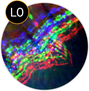
Unprocessed satellite payload data.
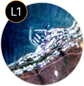
Radiometric, geometric, enhanced, and orthorectified imagery.
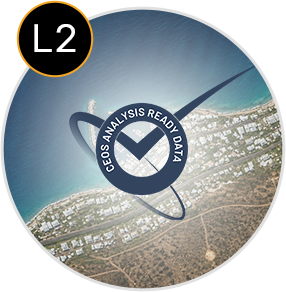
Surface reflectance, BRDF normalisation, and topographic correction.
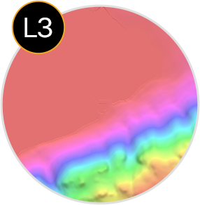
Mosaics, surface models, indices, data-cube products, and derived measurements.
Civil monitoring products, event services, and user-defined alerts.
Most ground segments stop near L1
L0 and L1 prepare and correct the data.
The value sits higher up
L2, L3, and L4 create the higher-order products.
Processing levels, product by product
A technical catalog of outputs across the full chain from raw sensor data to higher-order geoinformation products.
Level 0, raw sensor data
Decoded and reformatted raw downlink with quality flags and STAC metadata. Not intended for general use.
Level 1, calibrated, enhanced, orthorectified
Radiometric calibration, geometric correction, enhancement, and orthorectification move raw sensor data toward usable imagery for analysis and mapping.
Level 2, atmospheric and ARD
Atmospheric correction moves calibrated imagery toward analysis-ready surface products, with BRDF normalisation and topographic correction that exceed CEOS ARD target requirements.
Level 3, information products
Level 3 products turn calibrated and analysis-ready imagery into mosaics, surface models, indices, classifications, data-cube products, and derived information.
Level 4, geoinformation and event services
Level 4 products turn processed imagery and derived information into end-user geoinformation, monitoring products, event services, and notifications.
Movement and fire products are delivered as live event services, not just static layers. Detections are published to the IRMI™ catalogue and pushed through user-defined notification interfaces.
SAR products
SAR products extend the catalogue into interferometric surface models, terrain products, surface motion monitoring, and coherent change detection.
Calibration services
Calibration services support sensor performance before launch and across the mission lifetime, connecting instrument characterisation to operational processing.
For wide-area scanning sensors, IRMI™ can also produce high-resolution BRDF coefficient products, greenhouse-gas retrieval, and data-cube pan-sharpened multispectral imagery where the sensor and acquisition pattern allow.
Why the higher levels matter
Most ground segments stop near calibrated imagery. IRMI™ keeps going, extending the chain into analysis-ready products, information products, geoinformation services, and user-defined notifications.
Beyond CEOS ARD
Level 2 adds BRDF correction, topographic normalisation, and high-resolution BRDF products.
Multi-mission and multi-resolution
Mosaicking and compositing across missions, sensors, dates, and resolutions.
Data-cube integration
Clean, gap-free imagery, time-series products, and pan-sharpened multispectral outputs.
Higher-order products
Surface and terrain models, indices, classifications, greenhouse gas, and biomass products.
Live event services
Level 4 publishes events to the catalogue and user-defined notifications, not just static files.
Tell us the product you need.
We will define the right processing level, product chain, output format, and delivery approach for your mission.